Category Archives: Latest News

Latest News

Operating in RAAF Amberley controlled airspace under NOTAM, a V-TOL Seeker WeatherSat™ Multi-Rotor (MR) RPAS platform has been successfully flight tested to 8,000ft AMSL. The WeatherSat™ is a reusable scientific instrument designed to capture real-time weather modelling information that will be used for enabling NearSat HALE operations. CEO of V-TOL, Mark Xavier says, “The WeatherSat™ sensor designed by NearSat will provide V-TOL & NearSat critical weather information required to conduct safe & efficient high altitude RPAS operations. V-TOL & NearSat look forward to further testing the WeatherSat™ capability in our efforts to reach near-space with a NearSat fixed wing platform.

Latest News


Mounted to a V-TOL Seeker II Multi-Rotor (MR) RPAS platform, a NearSat proto-type WeatherSat™ has been successfully flight tested. The WeatherSat™ Seeker is a reusable scientific instrument designed to capture real-time weather modelling information. CEO of V-TOL, Mark Xavier says, “The Seeker WeatherSat™ will provide V-TOL & NearSat critical weather information required to conduct safe & efficient high altitude NearSat RPAS operations. We look forward to testing the WeatherSat™ capability to altitude shortly”.

Latest News

The Financial Review in association Deloitte will be holding the Australian Innovation Summit 2018 from 30-31 July at the Sofitel Sydney, Wentworth. A copy of the Agenda is attached. CEO/MD of V-TOL, Mark Xavier, has been invited to be a panel member on Insights & Interview addressing the topic, “Israel the Innovation Nation – what Australia should take on board”. “I look forward to participating on the Summit panel and sharing my experiences and opinions on why the Israelis have excelled in technological innovation”, says Mark.

AFR Innovation Summit Agenda

Latest News


Working for the World Bank on Project UAV4Resilience and with the assistance of the Australian Department of Foreign Affairs & Trade (DFAT), V-TOL Aerospace was placed in a unique position to conduct advanced hi-resolution survey operations using V-TOL designed & manufactured GosHawk II drone technology over the Kingdom of Tonga before (2017) and after the category 4 cyclone Gita event (Feb 18).  The Gita survey was safely completed in 5 days resulting in 300km² of hi-resolution survey data while operating in integrated/shared airspace. The World Bank has reported that this type of drone operation has never been conducted to this extent under these conditions before.


The following provides a sample and insight into what can now be provided as a disaster management & recovery “tool” for first responders in the field, NGOs, Government Agencies, the public, Insurance &  Banking organisations, etc, in a matter of days:


*Please note, you will need Google Chrome or Microsoft Edge to enable your browser to operate the interactive map slider


V-TOL VEURON™, a technology developed with the support of the QLD Government’s Advance QLD initiative, is V-TOL’s onboard robot machine vision & learning Aa (Advanced Automation) & Ai (Artificial Intelligence) capability.  An example of how the VEURON™ technology will automate damage assessment reporting will be made available shortly.


V-TOL’s air deployable survey teams have demonstrated how an effective Disaster Management & Recovery capability can now be delivered in a matter of days in most locations globally. In collaboration with technology partner NearSat, V-TOL believes this capability can potentially be delivered anywhere within hours.


For Further information please contact us at [email protected]

Latest News

Cyclone Gita

Category 4 Cyclone Gita hit Tonga in February this year with winds up to 233km/h. Gita was reported as the worst cyclone to pass so close to Tonga in 60 years causing widespread and severe damage. Emergency response teams struggled to assess damage around the capital on the main Island of Tongatapu. As a result, the Brisbane based V-TOL Aerospace Disaster Response Team was deployed by the World Bank with the support of the Australian Government with their GosHawk II UAVs to survey the Tongatapu Island Group. The GosHawk UAVs were launched from the Fua’amotu International Airport to map the main island as rapidly as possible.


cyclone-gita-snipped.pngvhje2056.jpgbshx1092.jpg


ADS-B mandatory for unrestricted Beyond Visual Line of Sight (BVLOS)

Automatic Dependent Surveillance – Broadcasting (ADS-B) was mandatory for the unrestricted integrated BVLOS operations during the Gita Response. The uAvionix ping20s transponder and FYXnav-B GPS ADS-B solution installed on the GosHawk facilitated real-time monitoring by Air Traffic Control (ATC) at Fua’amotu International Airport Tonga, the V-TOL team on Tonga, V-TOL HQ in Brisbane, commercial jets and Civil Aviation Authority of New Zealand. The ADS-B output was used by ATC as the primary means of separating commercial aircraft movements from the uAvionix ADS-B equipped UAVs when operating BVLOS from the tower.


31ef92da2766f751bb471c84ebb1a37f.pngv-tol-rpas-flight-coverage-tongatapu-gita-caputure-28.2.18.pngrpas-lo-bm-in-atc-coord-flt-ops-23.2.18.jpeg


2,500km of survey operations were flown 1000ft AMSL in just 5 days

At the completion of flight operations conducted by V-TOL:

  • 100% of Tongatapu was imaged (approximately 300km²)
  • 2,500km of BVLOS survey operations were flown 1000ft AMSL
  • 15km BVLOS range was reached from the V-TOL Team
  • 500GB of data was collected and processed

Latest News

With over 2,600km of RPAS operations at or above 1000ft AMSL over Tongatapu under Part 102 regulations, V-TOL has now achieved under Part 101, CASA & RAAF (Royal Australian Air Force) approval for day and night BVLOS operations above 400ft AGL  in RAAF controlled airspace at Marburg, Australia. “V-TOL will use this opportunity to further industry’s move towards demonstrating safe advanced RPAS operations in the Australian National Airspace on a regular basis”, says V-TOL CEO Mark Xavier. 

Latest News

20180228_111707

The World Bank and V-TOL Aerospace are using drones to support the government of Tonga in its Rapid Damage Assessment after Cyclone Gita.

A fleet of V-TOL Aerospace’s drones, Unmanned Aerial Vehicles, has been transported to Tonga with the support of the Australian government.

The Pacific regional representative for the World Bank, Michel Kerf, said the drones were being used to map the damage wreaked by Gita.

According to him, the mapping will be crucial to helping Tonga’s government determine priority areas for recovery and reconstruction.

Tonga has received a payout of more than US$3.5 mill from the Pacific Catastrophe Risk Insurance Company.

It is the first payout made by the region’s first catastrophe risk insurance platform established in 2016.

The company falls under the Pacific Catastrophe Risk Assessment and Financing Initiative which is a joint effort of the World Bank, the Asian Development and the Pacific Community with the financial support from Germany, Japan, the United Kingdom and the United States of America.

As well as the World Bank, governments of Australia and New Zealand, the ADB, the Japan International Cooperation Agency, European Union and United Nations Development Programme are helping Tongan authorities to identify priority sectors for the rapid damage assessment.

These sectors include housing, agriculture and energy.

*Original article without amendment can be found:

https://www.radionz.co.nz/international/pacific-news/351014/drones-help-tonga-s-cyclone-damage-assessment

Latest News

20180224_174546

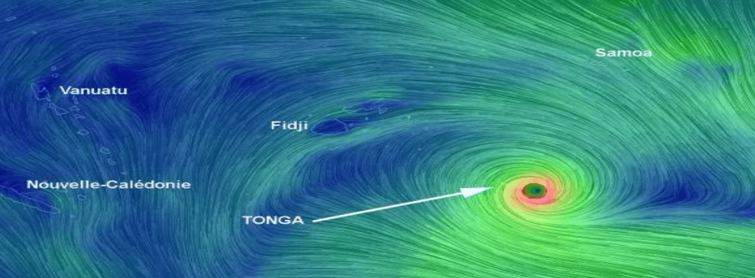
Nuku’alofa, February 22, 2018 – Following the severe impact of Tropical Cyclone Gita, the World Bank has now begun work to support the government of Tonga, which is leading a Rapid Damage Assessment to assist with recovery and reconstruction planning in the coming months.

“Our work in mapping the damage wreaked by Cyclone Gita will be crucial to helping the government of Tonga to determine priority areas for recovery and reconstruction,” said World Bank Country Director for Papua New Guinea and the Pacific Islands, Michel Kerf. “In the immediate aftermath of recent natural disasters in the Pacific, including cyclones Winston (Fiji, 2016) and Pam (Vanuatu, 2015), the World Bank has been called upon to lead the immediate damage assessment process.”

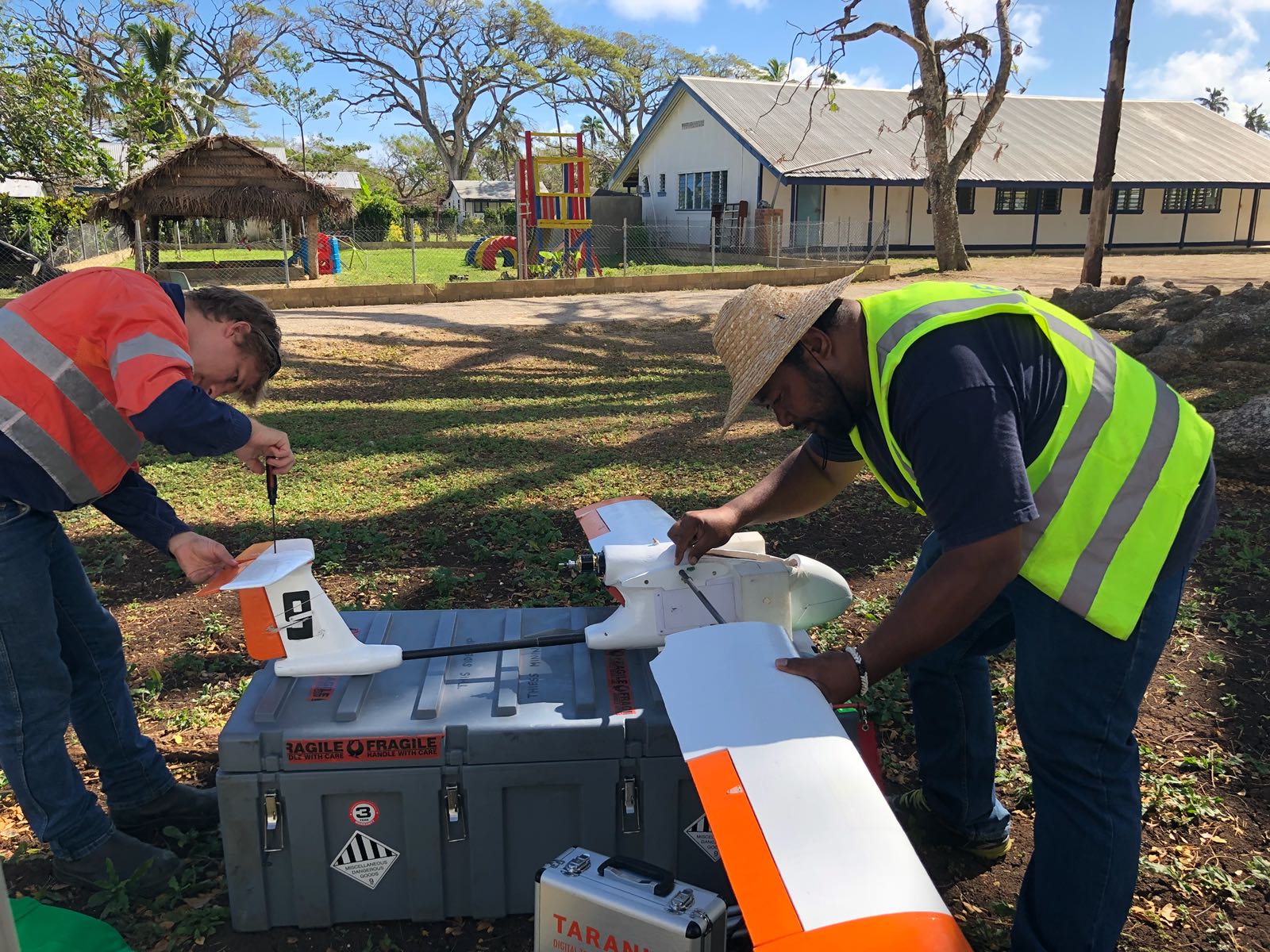
The World Bank, together with partners including V-TOL Aerospace (UAV Services provider), the governments of Australia and New Zealand, the Asian Development Bank, Japan International Cooperation Agency, European Union and United Nations Development Programme, is now working alongside Tongan authorities to identify priority sectors for the rapid damage assessment, which include housing, agriculture and energy.

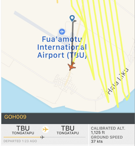
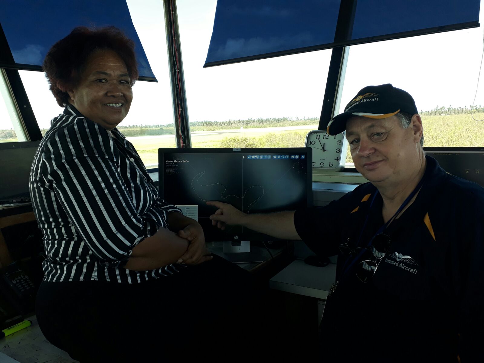
As part of this assessment work, a fleet of Unmanned Aerial Vehicles (UAVs, or drones) have been transported to Tonga with the support of the Australian government, to provide a comprehensive visual assessment of the damage caused by Cyclone Gita.

Tonga has received a payout of more than US$3.5 million from the Pacific Catastrophe Risk Insurance Company (PCRIC) – the first payout made by the region’s first catastrophe risk insurance platform established in 2016. PCRIC was formed as part of the World Bank’s regional project PCRAFI: Furthering Disaster Risk Finance in the Pacific, which provides technical assistance to 14 Pacific Island countries, with financial support from Germany, Japan, the United Kingdom and the United States of America.

“Despite the tragic circumstances, it has been good to see the Pacific Catastrophe Risk Insurance Company delivering much-needed relief through its disaster insurance system,” said Mr. Kerf. “This is the first payout of its kind, and is a testament to the hard work of many governments and development partners, who have worked hard over many years to create this critical support system for the Pacific Islands, home to many of the world’s most disaster at-risk countries.”

The World Bank continues to stand as a dedicated partner in resilient development in the Pacific Islands.

 *original article without additions can be found:
 http://www.worldbank.org/en/news/press-release/2018/02/22/tonga-world-bank-drone-led-damage-assessments-underway