Note: Some interactive items on this page may require Google chrome or Microsoft Edge browsers to view correctly.
Customer:


Supported By


Problem and Location:
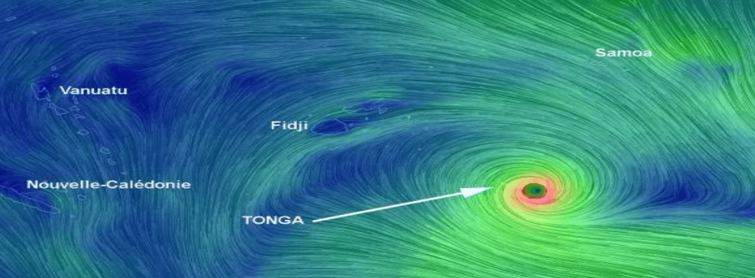
On Monday 12th February 2018, Tropical Cyclone Gita impacted the main island of Tongatapu in Tonga, as a category 4 cyclone, with wind speeds reaching up to 233km/hr. A state of disaster was declared on the island and the clean up and repair process began.
V-TOL Aerospace’s assistance was offered and accepted by The World Bank, the National Emergency Management Office of Tonga, and supported by DFAT and the Government of Tonga (Particularly the Civil Aviation Department).

“V-TOL Aerospace’s Goshawk Surveyor aircraft was able to operate to a 10km radius, survey 15km2 per flight, and was critical to surveying 270km2 in 5 days to assess damage following tropical cyclone Gita.”
How we did it:
September/October 2017
The UAV4Resilience project initiated by The World Bank and conducted by V-TOL Aerospace was aimed at developing UAV capabilities for small pacific island nations. The project involved using LiDAR, high resolution optical and Multi-spectral payloads, as well as fixed wing, multi rotors and boat launched and recovered aircraft on the islands nations of Fiji and Tonga.
During this project, V-TOL Aerospace (who helped develop the UAV regulatory framework in Fiji, including providing drone training to key CAA personnel) worked with CAD (Civil Aviation Department) Tonga and PASO (Pacific Aviation Safety Office) to develop procedures for integrating drones into the national airspace, and in doing so gained Tonga’s first Part 102 certificate.

Data collected during the project (~100km2 over a month) was collated and presented to the National Emergency Office (NEMO) as a partial baseline in preparation for a natural disaster.
72 Hours after receiving deployment Request
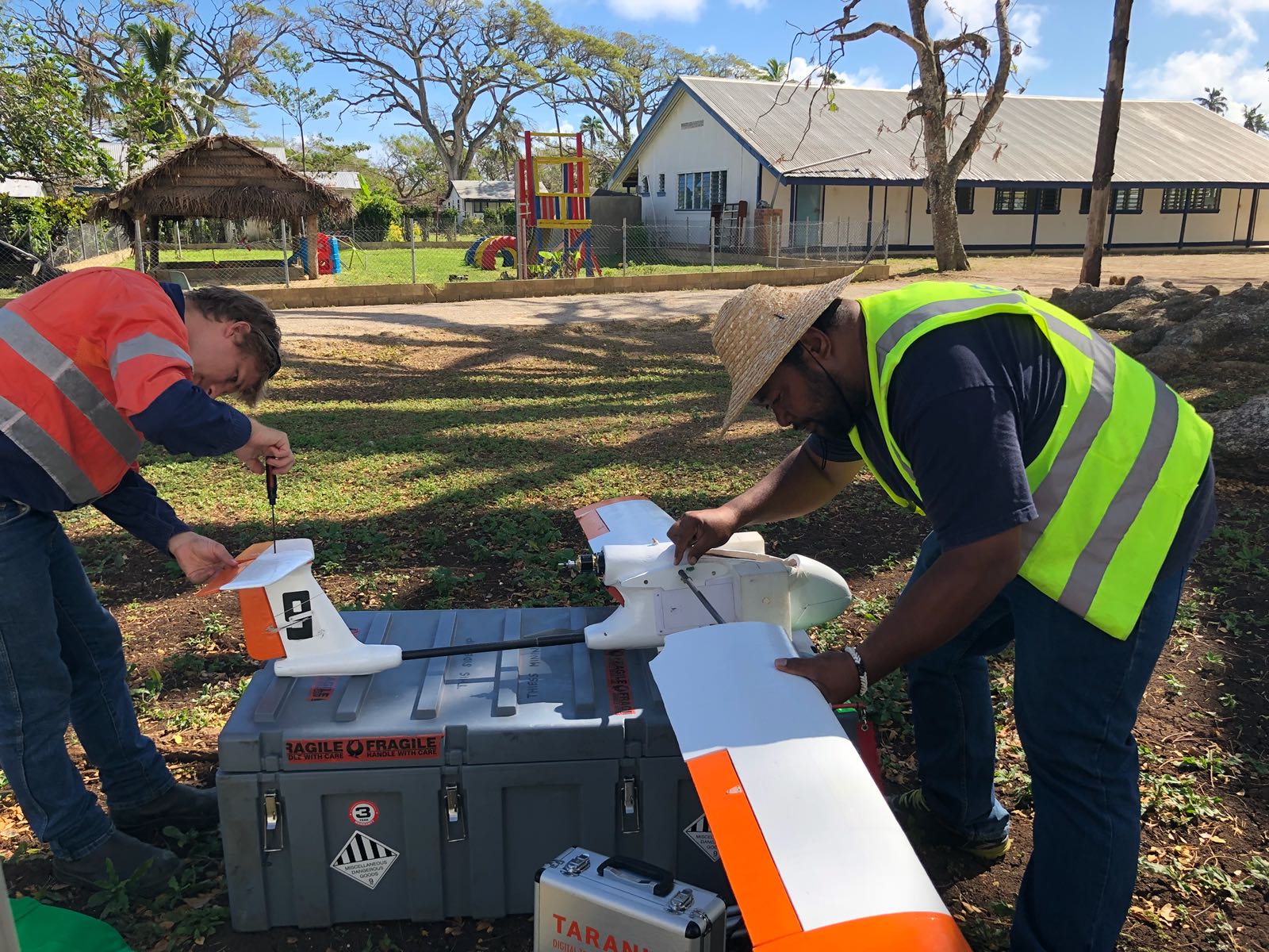
After Tropical Cyclone Gita impacted Tongatapu, and within 72 hours of receiving the deployment request from The World Bank, V-TOL Aerospace deployed to Tonga on a RAAF C130 with a DFAT assistance cargo flight. V-TOL’s deployment team met with NEMO, CAD and ATS to discuss how best V-TOL’s services could be implemented.


5 Days after Arrival
After 5 days on island, V-TOL Aerospace had successfully mapped the entire of Tongatapu, excluding military and royal compounds (approximately 270km2 to 7cm GSD) using our Goshawk surveyor aircraft. Operations were conducted from the Airport, Schoolyards, Monasteries and sports stadiums, with an operational radius of 10km, allowing up to 15km2 to be covered per flight. While using drones to survey an entire island in a post natural disaster event is in itself groundbreaking, the successful integration of the drones into the operational national airspace was also revolutionary. The use of ADS-B technologies fitted to drones enabled the ATS to separate commercial and disaster response vehicles, whilst also enabling our chief pilot to monitor and co-ordinate operations from the head office in Brisbane.


Post Survey
Following the successful data capture of the island, the 500GB of data and processed files were collated and handed to NEMO. This data was used to assess damage, identify areas of most need of assistance, and how best to allocate resources. Furthermore, the data collection and response phase enabled learnings that will help other pacific island nations develop there own post-disaster management procedures, and how best to integrate drones as another tool to assessment and survey.


Flood Mapping Sopu Tongatapu (in meters AMSL)